The rhythm of the Indian monsoon shapes the country’s food security, economy, and daily life. For over a century, the standard convention—set by the India Meteorological Department (IMD)—has held that the onset of monsoon is first witnessed in Kerala. Yet, brand-new research employing complex network theory is upending this tradition: rain often starts in Northeast India before Kerala. Discerning the real “onset” of monsoon at a hyper-local level now promises the most precise, actionable forecasts for farmers and disaster planners ever. PIB IITMadras
Why Traditional Monsoon Forecasts Are Under Challenge
India’s conventional monsoon calendars serve as crucial signals for the start of sowing, irrigation, and rural planning. They predict monsoon’s northward arrival by monitoring rain in Kerala. But growing evidence shows that these broad-brush forecasts can mislead farmers thousands of kilometers away.
The Problem:
- Monsoons are not a single “wave”: Local rainfall can begin well before—or after—the official onset.
- Sowing errors: If North-Eastern states get rain earlier, but sow only after Kerala’s “signal,” crop yields can suffer, and crucial planting windows may be missed.
The Solution: Data-Driven, Granular Onset Mapping
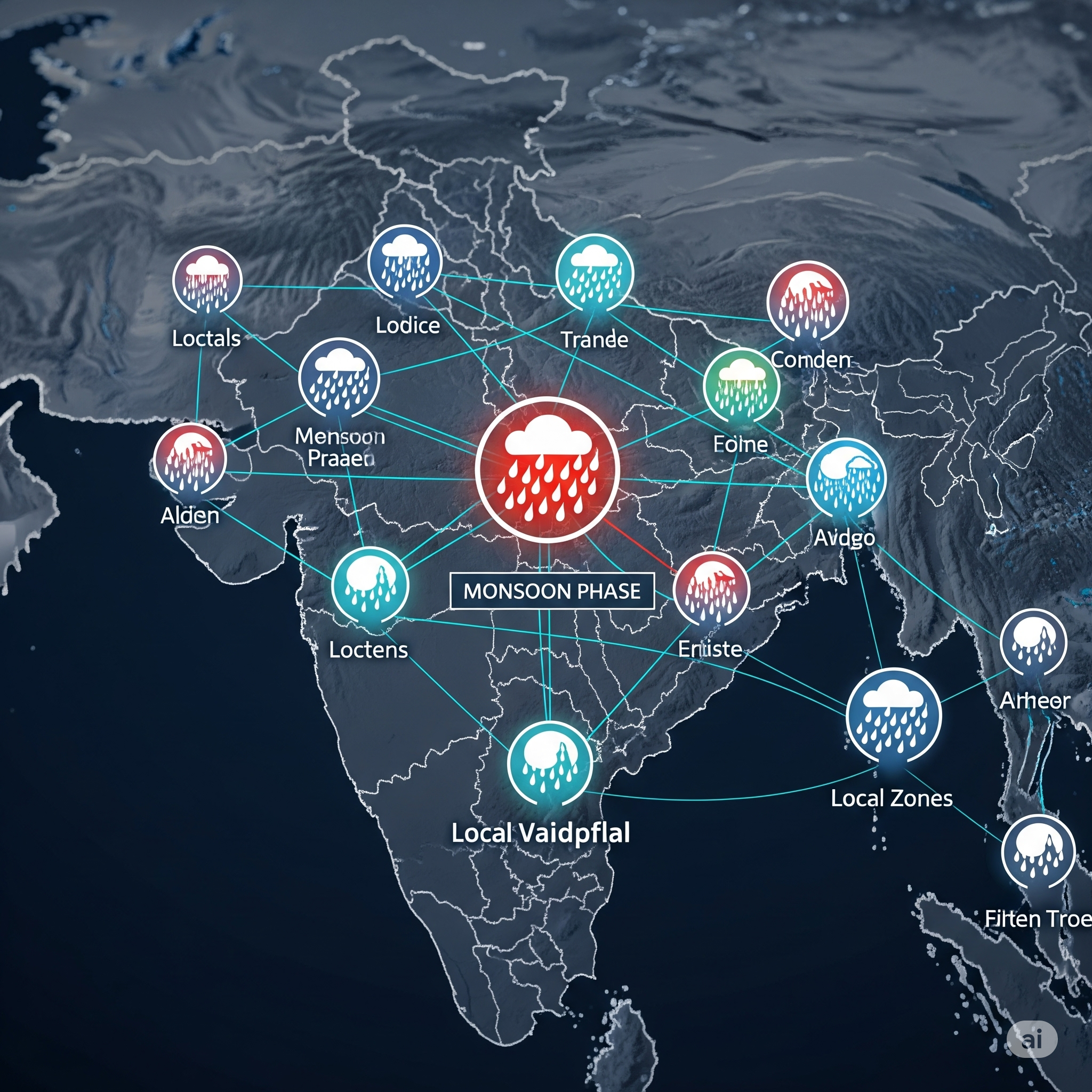
A team of scientists has harnessed complex network theory—a form of advanced mathematical modeling—to analyze how scattered local clusters of rainfall across India merge over time into a truly “national” monsoon phase. Their findings:
- Northeast India can see consistent monsoon rainfall up to a week before Kerala does, due to unique geographic and climatic factors.
- Onset is not a single line sweeping from south to north, but a choreographed merging of local rain clusters—each with its own timeline and triggers.
- Using dense, region-by-region rainfall and atmospheric data, the model draws granular maps of when each district really enters the monsoon season.
How Complex Network Theory Works for Monsoons
Instead of treating the monsoon as a simplistic, uniform weather front, the new method:
- Divides the Indian subcontinent into many “nodes”—each representing a geographic zone or weather station.
- Tracks spontaneous local rainfall events (“clusters”) and how, over days, these clusters grow, merge, and synchronize.
- Pinpoints the “tipping point” where local rain transitions into sustained, monsoon-pattern precipitation for any given region—not just for Kerala.
Key Finding: Monsoon “onset” isn’t defined by Kerala’s first heavy rain—for Eastern and Northeast India, it can be earlier. For North, West, and Central India, true rainfall onset can be much later than the Kerala signal.
Why Does This Matter? The Agriculture and Warning Edge

1. Smarter Crop Sowing and Inputs
- Farmers in Assam, Tripura, and nearby Northeast states can sow earlier—optimizing crop cycles, yield, and resource usage.
- Farmers elsewhere avoid the risk of premature sowing, ensuring seeds aren’t washed away by heavy pre-monsoon showers or left to dry in late-arriving rains.
2. Improved Early Warning for Floods and Drought
- Disaster management agencies can deploy resources when true season onset looms, not just when the monsoon crosses Kerala.
- Insurance, irrigation, and food security planners benefit from district-specific rain onset mapping to avoid economic shocks.
3. Fewer Mistakes, More Data-Driven Governance
- Replaces “one-size-fits-all” IMD monsoon onset signals with customized, science-backed regional alerts.
- Supports India’s climate-resilient agriculture push and enhances global credibility in climate risk mapping.
A Visual Journey: How Monsoon Onset Actually Unfolds
Old Model (IMD Convention)
- Monsoon officially “arrives” in Kerala (late May/early June).
- Media, ministries, and millions treat this as the start gun for the country.
- Sowing, irrigation, and supply plans nationwide follow the Kerala timeline.
New Model (Network Theory)
- Northeast (e.g., Assam) gets consistent monsoon-intensity rain—before Kerala.
- Central and Southern India: Clusters merge later, based on local conditions (wind, temperature, pressure).
- Onset map “fills in” regionally, creating a dynamic, real-time national entry to the monsoon phase.
Practical Guide for Readers: What Changes on the Ground
- For Farmers: Monitor district-wise rainfall alerts, not just national monsoon onset. Local weather departments and agri-apps will soon offer network-model-based forecasts.
- For Policy Makers: Prioritize input delivery, crop planning, and disaster response using regional rainfall “phase maps”—minimizing loss and boosting productivity.
- For Citizens and Planners: Expect more nuanced disaster warnings and water management cues, tailored for your locality.
“Old” vs “New” Monsoon Onset
| What’s Measured | IMD Traditional | Complex Network Theory Model |
|---|---|---|
| Official “start” | Kerala | District-by-district, pan-India |
| Local rain recognized? | No | Yes — true local onset flagged |
| North-East recognized? | Often ignored early | Marked as first onset in many years |
| Sowing signals | National | Localized, timely |
| Early warning utility | Limited | High—flexible and precise |
Conclusion
India’s monsoon is no longer a blunt, all-or-nothing event—it is a dynamic, living phenomenon, with every region dancing to its own rain-driven tune. By marrying complex network theory with deep meteorological data, Indian science offers a leap forward in how we forecast, prepare, and thrive in the shadow of the monsoon. For farmers, planners, and everyone who counts on the rains, this new precision isn’t just academic—it’s the recipe for a safer, smarter, and more resilient monsoon season.


+ There are no comments
Add yours