
The powerful synergy between geospatial technology and disaster governance enables real-time monitoring, evidence-based flood preparedness, and strategic resource allocation, revolutionizing how communities prepare for and respond to natural disasters.
Key Highlights
- Remarkable prediction accuracy: AI-powered satellite systems achieve over 90% flood prediction accuracy by analyzing meteorological and flood data, enabling precise inundation forecasting
- Response time reduction: Management Information Systems (MIS) combined with geospatial technology reduce disaster response times by up to 30% through enhanced decision-making and resource optimization
- Massive economic returns: Early Warning Systems provide more than tenfold return on investment, with just 24 hours’ notice reducing damage by 30%
- Global coverage gaps: Despite proven effectiveness, half of all countries lack comprehensive Early Warning Systems, with coverage worst in Least Developed Countries and Small Island Developing States
- Real-time capabilities: Modern systems deliver satellite imagery within 20 minutes of acquisition, enabling rapid assessment and immediate response coordination
The Technology Stack: Building Intelligent Disaster Systems
Satellite Technology and Remote Sensing
Geospatial technology encompasses remote sensing, Geographic Information Systems (GIS), and Global Navigation Satellite Systems (GNSS), forming the backbone of modern disaster management. These technologies enable hazard, risk, and vulnerability mapping, supporting effective evacuation planning and strategic resource allocation.
Brazil’s Lessonia-1 SAR Project exemplifies cutting-edge implementation, deploying Synthetic Aperture Radar (SAR) satellites for real-time disaster monitoring. Operating in X-band with VV polarization imagery, these satellites penetrate cloud cover to provide continuous observations even in challenging conditions like the Amazon rainforest. isprs-archives
Machine Learning and Predictive Analytics
Artificial Intelligence integration has revolutionized flood forecasting capabilities. Long Short-Term Memory (LSTM) and Convolutional LSTM (ConvLSTM) models demonstrate exceptional performance, achieving R² values of 0.96 and Nash-Sutcliffe efficiency of 0.95.
ConvLSTM networks excel by capturing spatial dependencies between input variables including precipitation, temperature, and wind patterns. This spatial-temporal analysis capability proves crucial for accurately predicting discharge at watershed outlets, where complex variables interact across multiple dimensions.
Internet of Things (IoT) Integration
IoT-based systems enable continuous real-time monitoring through networks of water level sensors, environmental sensors, and communication modules. SentryLeaf, an innovative IoT network for flood monitoring, achieves ±2 cm accuracy in water level measurements under ideal conditions.
The system’s decentralized architecture ensures reliable communication even without traditional networks, maintaining stable connections over 200-meter distances despite obstructions. This peer-to-peer communication protocol demonstrates remarkable resilience under harsh conditions.
Evidence-Based Flood Preparedness: From Prediction to Action
Real-Time Monitoring Capabilities
High-resolution optical and radar imagery enables precise flood mapping with resolutions as fine as 15-30 cm. This unprecedented detail allows authorities to identify flooded areas, assess infrastructure damage, and evaluate impacts on buildings and vegetation with remarkable accuracy.
Very-high-resolution satellites like WorldView-2 and WorldView-3 provide comparative analysis capabilities, enabling before-and-after assessments that reveal the full extent of flooding impacts. This temporal analysis proves invaluable for damage assessment and recovery planning.
Early Warning System Architecture
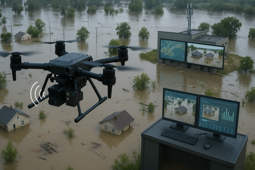
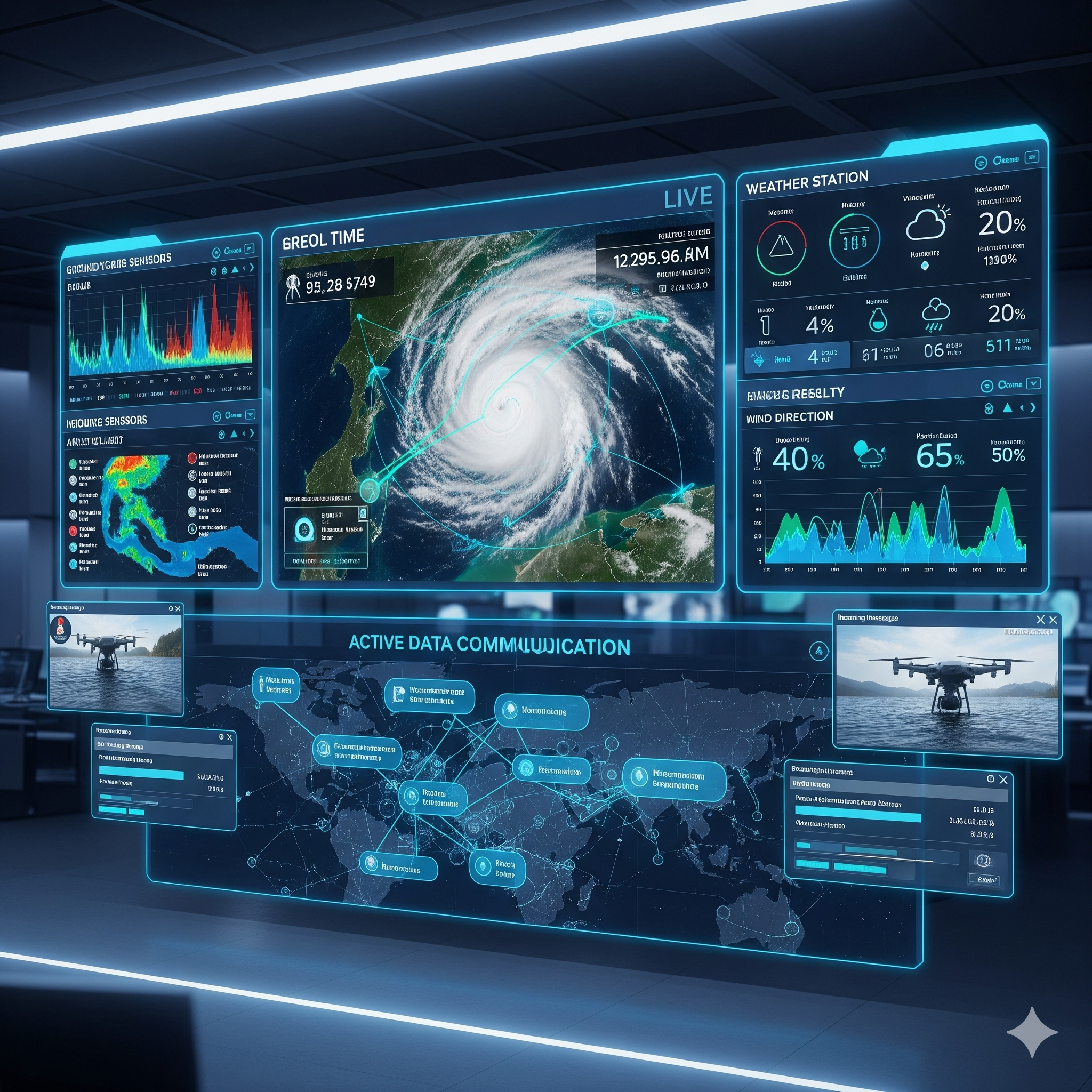
Multi-hazard Early Warning Systems (MHEWS) integrate multiple data sources including satellite imagery, weather data, social media feeds, and sensor networks. This comprehensive data integration enables emergency response teams to quickly analyze real-time information and create detailed situation maps.
India’s success in cyclone early warning demonstrates the transformative potential. The country achieved nearly 100% Early Warning System coverage for cyclones on both coasts, reducing cyclone mortality by up to 90% over 15 years.
Predictive Modeling Excellence
Advanced machine learning algorithms process vast amounts of historical and real-time data to predict flood events with increasing precision. Integration of satellite data with ground-based sensors and weather forecasting models creates comprehensive prediction systems.
River Tana flood monitoring system in Kenya achieved 85% accuracy in predicting flood events through ultrasonic sensor integration with predictive analytics. The system issues SMS-based alerts when potential flood events are detected, ensuring timely communication even in areas with limited internet access.
Strategic Resource Allocation: Optimizing Emergency Response
Geographic Information Systems (GIS) Applications
GIS technology serves as the central nervous system for disaster resource allocation, enabling spatial analysis for risk assessment, hazard mapping, and emergency response coordination. The technology integrates various data sources to assess impact and prioritize response efforts.
Risk assessment capabilities allow authorities to conduct detailed vulnerability analyses and create comprehensive hazard maps crucial for urban planning and development. These evidence-based assessments inform zoning regulations and land-use planning, ensuring high-risk areas avoid critical infrastructure development.
Resource Optimization Algorithms
Decision Support Systems (DSS) combined with GIS tools significantly improve spatial data analysis, enabling better-targeted relief efforts. This integration enhances situational awareness and allows for more effective resource allocation and coordination among emergency services.
Real-time data sharing platforms enable coordinated response efforts by integrating data from multiple agencies. Different response teams can access shared geospatial information including situation maps, evacuation plans, and resource locations.
Communication and Coordination Networks
Advanced communication systems ensure seamless information flow between command centers, field teams, and affected communities. Near real-time satellite data delivery within 20 minutes of acquisition enables rapid decision-making and immediate response coordination.
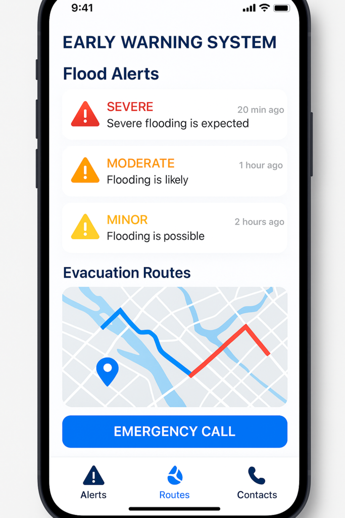
Mobile-based alert systems provide critical early warnings through SMS notifications, mobile apps, and digital platforms. These multi-channel approaches ensure message delivery reaches diverse populations regardless of technological access levels.
Global Success Stories and Implementation Models
India’s Leadership in Geospatial Disaster Management
India exemplifies successful geospatial technology integration across all phases of disaster management. The Indian Space Research Organization (ISRO) facilitates extensive training programs that promote widespread geospatial technology adoption.
Government commitment and leadership enabled comprehensive Early Warning System implementation for hydrometeorological hazards. India’s capacity building initiatives extend beyond national borders through the Centre for Space Science and Technology Education in Asia and the Pacific (CSSTEAP).
International Cooperation Models
Brazil’s Lessonia-1 SAR Project demonstrates dual-purpose satellite deployment addressing both military and civilian disaster management needs. The Space Operations Center (COPE) acquires SAR imagery to support joint operations mitigating natural disasters including flooding and wildfires.
European Union’s Copernicus Program provides free satellite data to countries for risk assessment and emergency response. This international cooperation model enables resource sharing and knowledge transfer between developed and developing nations.
Technology Integration Frameworks
Digital twin technology represents the future of disaster management, creating bidirectional data flow between digital models and physical environments. 3D city modeling combined with early warning systems enhances climate resilience through comprehensive situational awareness.
Web-GIS platforms integrating high-resolution drone and satellite data enable precise flood mapping, inundation simulations, and population impact assessments. IIT Kanpur’s TerrAqua UAV project demonstrates scalable real-time flood management frameworks combining UAV and satellite inputs.
Challenges and Future Directions
Technical and Infrastructure Barriers
Data interoperability, cybersecurity concerns, and advanced technology integration remain significant barriers to fully leveraging geospatial systems. Standardized protocols and specialized training are essential for maximizing MIS potential in disaster response efforts.
Limited geospatial data modeling capabilities in many regions, combined with internet bandwidth constraints and trained human resource availability, create ineffective disaster management processes. Capacity building initiatives must address these fundamental infrastructure gaps.
Socio-Organizational Considerations
Long-term Early Warning System effectiveness requires integration of technical capabilities with socio-organizational factors. Community acceptance and participation significantly influence system sustainability and operational success.
Rural area implementation faces unique challenges including limited connectivity, resource constraints, and community engagement needs. Successful systems must balance technological sophistication with local knowledge integration and community participation.
Innovation and Development Priorities
Future research directions emphasize data fusion techniques, real-time processing capabilities, model generalization, and UAV technology enhancements. Training programs for rescue teams and community capacity building remain crucial for comprehensive disaster management improvement.
Artificial Intelligence advancement focuses on pattern recognition, predictive analytics, and automated response systems. Disruptive technologies including robotics, machine learning, and smartphone applications offer significant potential for expediting disaster response and improving efficiency.
Economic Impact and Return on Investment
Cost-Benefit Analysis
Early Warning Systems provide exceptional economic returns, with Global Commission on Adaptation findings showing more than tenfold return on investment. Spending just $800 million on systems in developing countries would prevent losses of $3-16 billion annually.
24-hour advance warning can reduce disaster damage by 30%, demonstrating immediate economic benefits beyond life-saving potential. This cost-effectiveness makes Early Warning Systems the “low-hanging fruit” for climate change adaptation.
Market Growth and Investment Trends
India’s geospatial industry projects 12.8% growth rate, with valuation expected to reach INR 63,000 crore by 2025. The sector will provide employment to more than 10 lakh people, demonstrating substantial economic development potential.
Government and state agencies collectively spent around INR 300 crore on geospatial program components as of 2022. Infrastructure segment mandates require 8% of project budgets allocated to geospatial technologies in rural development, power, and natural resources.
Conclusion
The synergy between geospatial technology and disaster governance represents a paradigm shift in how societies prepare for, respond to, and recover from natural disasters. Real-time monitoring capabilities, evidence-based preparedness, and strategic resource allocation have transformed theoretical disaster management into actionable, life-saving interventions.
Success stories from India’s cyclone warning systems, Brazil’s SAR satellites, and Kenya’s flood monitoring networks demonstrate that technology integration can achieve dramatic improvements in disaster outcomes. 90% reductions in cyclone mortality and 30% decreases in disaster damage through 24-hour early warnings prove the transformative potential.
However, global coverage gaps and implementation challenges remind us that technology alone cannot solve disaster management. Socio-organizational factors, community participation, and capacity building remain equally crucial for sustainable success.
The future lies in continued innovation, international cooperation, and comprehensive approaches that balance technological sophistication with community needs and local knowledge integration. Investment in geospatial disaster management offers exceptional returns while saving lives and protecting economies.
Mains Questions
- “How does satellite-based flood monitoring improve governance responses in flood-prone regions? Discuss practical and policy dimensions.”
- “Evaluate the integration of ISRO’s flood hazard zonation tools in state-level flood management planning. What improvements would you suggest?





+ There are no comments
Add yours