What Is Google FireSat?
Google’s FireSat project is a cutting-edge initiative that combines artificial intelligence (AI), satellite imaging, and remote sensing to detect wildfires from space. Launched in collaboration with climate scientists and disaster response experts, FireSat uses real-time satellite data and machine learning algorithms to spot signs of fire across vast forested and rural regions before they become unmanageable.
In a world where climate-induced disasters are on the rise, this technology could be the difference between a contained flame and a full-blown catastrophe.
📈 Why Wildfire Detection Matters More Than Ever
In 2023 alone, over 47 million acres were burned globally due to wildfires, with damages totaling billions of dollars and thousands of lives impacted.
Climate change, rising temperatures, and extended dry seasons have made wildfires more frequent and intense, especially in:
- California, USA
- British Columbia, Canada
- Australia
- Southern Europe
- Uttarakhand and Himachal Pradesh in India
Early detection and faster response times can significantly reduce the destruction caused by these blazes.
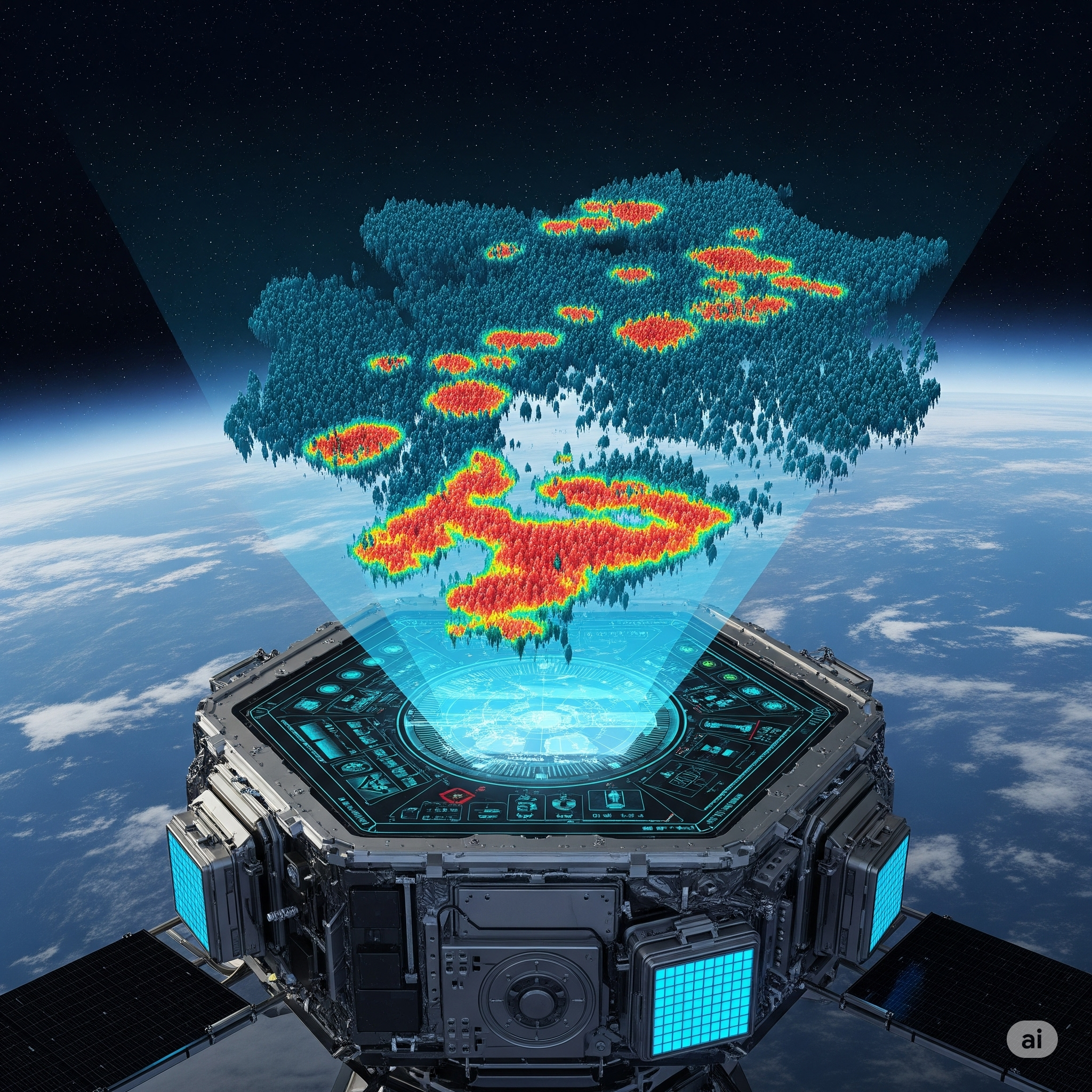
🤖 How Does FireSat Work?
1. AI + Satellite Imaging
FireSat continuously scans the Earth’s surface using both geostationary and low-Earth orbit (LEO) satellites. AI algorithms are trained to detect subtle temperature anomalies, smoke plumes, and vegetation dryness using:
- Infrared imaging
- Visual spectrum detection
- Pattern recognition of smoke movement
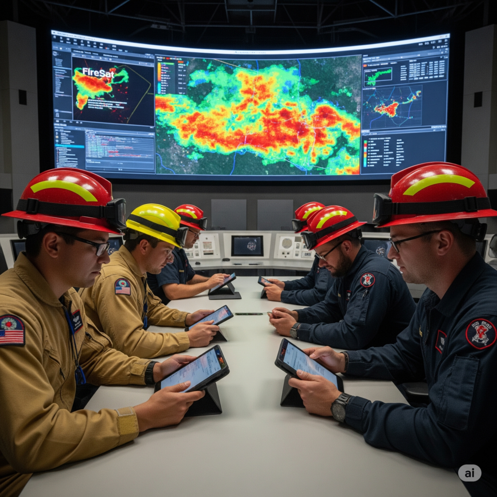
2. Real-Time Alert System
When a fire-like anomaly is detected, FireSat sends:
- Immediate alerts to disaster response agencies
- Geolocation data with estimated fire size and intensity
- 3D heat maps that evolve as the fire spreads
3. Predictive Modeling
FireSat’s AI can forecast the path of wildfires by analyzing wind, humidity, topography, and vegetation density, helping governments deploy firefighting teams more strategically.
“This isn’t just detection. It’s about anticipating disaster,” said a Google AI research scientist during the launch.
🌿 A Game-Changer for India
India has seen a significant rise in forest fires, especially in ecologically sensitive zones like:
- Western Ghats
- Himalayan belt
- Odisha and Chhattisgarh
According to the Forest Survey of India (FSI), 31,000 forest fires were recorded in 2022 alone.
Benefits of FireSat for India:
- Real-time coverage of remote forested zones
- Integration with local disaster management tools
- Enhanced monitoring during dry pre-monsoon seasons
- Empowering forest rangers with mobile-based alerts
🌍 Global Collaboration: NASA, ESA, and Google
FireSat is also part of a broader movement toward space-based climate governance. It complements systems like:
- NASA’s MODIS and VIIRS sensors
- European Space Agency’s Copernicus Program
These collaborations enhance global coordination and create a seamless web of early warning systems for developing countries.
⚖️ Limitations and Ethical Concerns
While promising, FireSat raises key concerns:
- Data Privacy: Satellite surveillance can lead to unintended violations of privacy.
- False Positives: Mistaking industrial smoke or thermal activities as fires.
- Access Equality: Will rural and underdeveloped nations get timely alerts?
Thus, it’s critical to develop equitable frameworks for tech deployment.
🚨 The Future of Disaster Management
FireSat signals a shift from reactive to proactive disaster response. In the coming years, we could see:
- Drones dispatched automatically post-alert
- Integration with smart city warning systems
- Community-led firefighting initiatives using mobile alerts
With governments increasingly aligning climate budgets toward resilience and adaptation, space-based AI tools will be a key part of the new toolkit.
💡 Final Thoughts
Google’s FireSat shows us what’s possible when AI, space science, and environmental urgency come together. In an era where minutes matter during a wildfire, spotting danger from space isn’t sci-fi—it’s smart policy.
Investing in such technologies is no longer optional. It’s the new frontline in the fight against climate emergencies.


+ There are no comments
Add yours